|
|
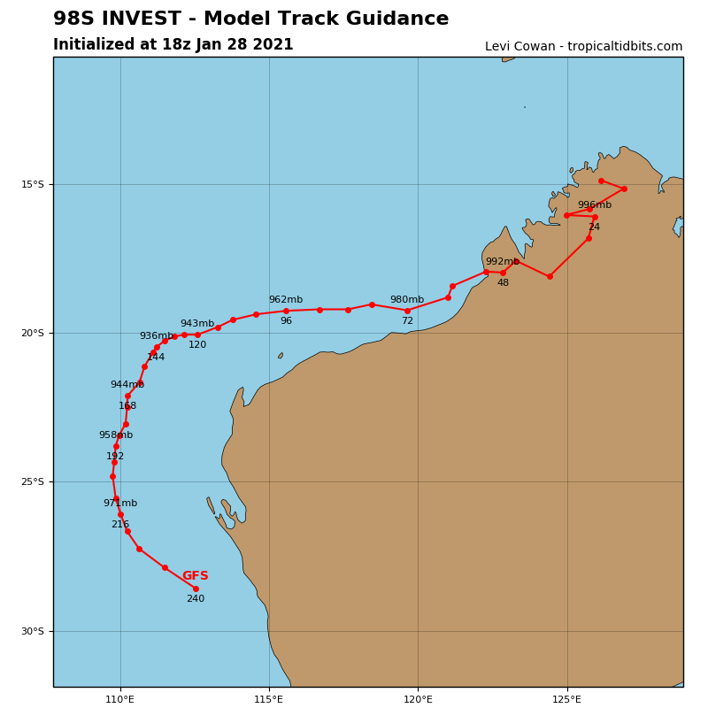
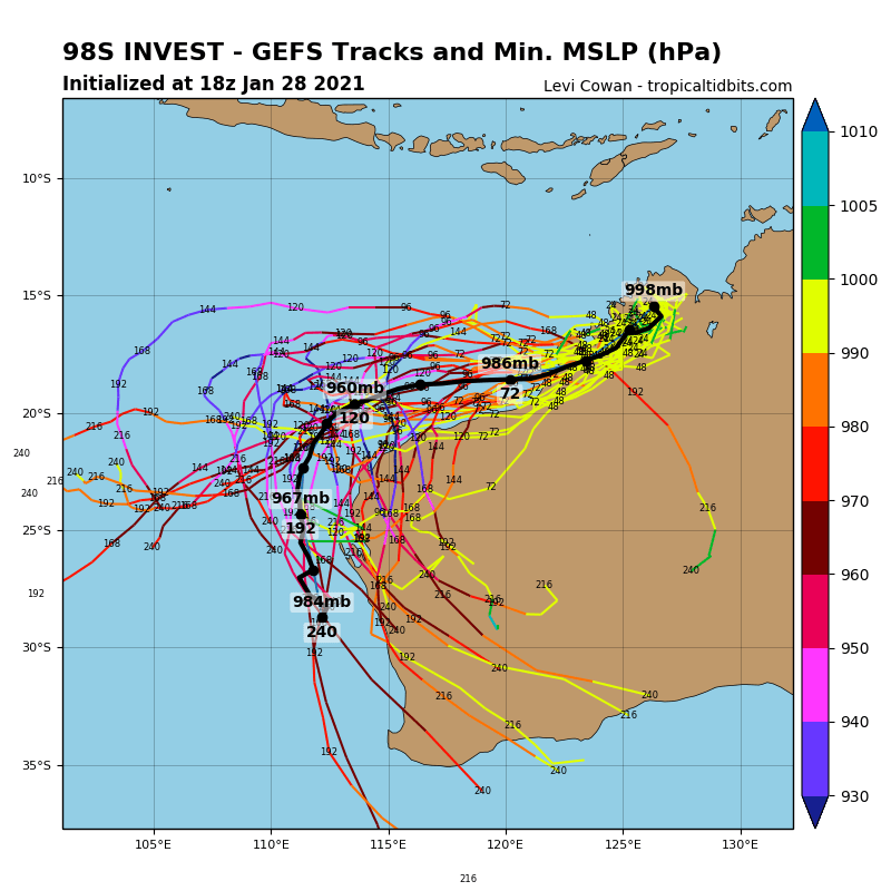
BOM編號12Uropical low (12U) was located over the northern Kimberley, about 150 kilometres south southwest of Kalumburu and 500 kilometres east northeast of Broome at 2pm WST Thursday 28 January. It is forecast to track southwest over the next few days and is expected to bring heavy rainfall, particularly through northern and western parts of the Kimberley.
The most likely scenario is for 12U to move offshore from the west Kimberley coast near Broome on Sunday and continue moving west parallel to the Pilbara coast next week. Once offshore, it is likely to strengthen into a tropical cyclone, and this could occur very soon after the low moves over open waters. There is the potential for this system to become a severe tropical cyclone as it tracks over waters to the north of the Pilbara.
There remains a chance the system moves further south, doesn't make it to open water and tracks west across the inland Pilbara, with heavy rainfall expected near the system.
Likelihood of this system being a tropical cyclone in the Western Region on:
Friday:Very Low
Saturday:Low
Sunday:High


|
|