At 9:30 am CST [10:00 am EST] on Monday 25 January, a developing tropical low (11U), 1003 hPa, was located in the central Gulf of Carpentaria, near 14.7S 138.8E, about 220 km north of Mornington Island and 260 km east southeast of Groote Eylandt. The tropical low is forecast to move slowly eastwards on Monday and be located over the eastern Gulf of Carpentaria on Tuesday. From Wednesday, the tropical low may become slow moving over the eastern Gulf of Carpentaria with an increasing risk of forming into a tropical cyclone. The system may persist as a tropical cyclone in the Gulf of Carpentaria until the weekend, although there is also a chance that it moves inland of the eastern Gulf coast sooner, or moves towards the southern Gulf coast.
Likelihood of this system being a tropical cyclone in the Northern Region on:
Tuesday:Very Low
Wednesday:Moderate
Thursday:High
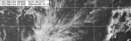
(1) AN AREA OF CONVECTION (INVEST 94P) HAS PERSISTED NEAR
14.8S 139.2E, APPROXIMATELY 130 NM NORTH OF MORNINGTON ISLAND,
AUSTRALIA. ANIMATED MULTISPECTRAL SATELLITE IMAGERY DEPICTS CYCLING
DEEP CONVECTION OVER A BROAD LOW LEVEL CIRCULATION (LLC) WITH
ADDITIONAL FLARING CONVECTION TO THE NORTH. A 250407Z ASCAT-A IMAGE
INDICATES AN ELONGATED CIRCULATION WITH SOME 20-25KT WIND BARBS TO
THE EAST AND 15-20KT WINDS TO THE NORTHWEST. UPPER LEVEL ANALYSIS
INDICATES A MODERATELY FAVORABLE ENVIRONMENT WITH EQUATORWARD
OUTFLOW AND WARM (29-31C) SEA SURFACE TEMPERATURES OFFSET BY
MODERATE TO HIGH VERTICAL WIND SHEAR (20-25KTS). GLOBAL MODELS
INDICATE 94P TRAVELING GENERALLY EASTWARD AS IT INTENSIFIES.
MAXIMUM SUSTAINED SURFACE WINDS ARE ESTIMATED AT 15 TO 20 KNOTS.
MINIMUM SEA LEVEL PRESSURE IS ESTIMATED TO BE NEAR 1003 MB. THE
POTENTIAL FOR THE DEVELOPMENT OF A SIGNIFICANT TROPICAL CYCLONE
WITHIN THE NEXT 24 HOURS IS UPGRADED TO LOW.

.png")